Be a part of my adventure

Latest

Few destinations in mind

Here are my upcoming travel destinations in no particular order. The book America’s Spectacular National Park was helpful in writing this post. Thanks to my friend Shahnila who gave me this book before she left for Singapore. After traveling these destinations, I will have twenty-two more national parks under my belt.

1. Alaska

The largest state of the United States (twice as big as Texas) was purchased from the Russians for about two cents per acre for $7.2 million. Its location and climatic conditions makes traveling to Alaska challenging but summer is best time to travel with limitless daylight. This vast landscape has a lot to offer: 3 million lakes, 29 volcanoes, 100,000 glaciers and Mount McKinley (tallest point in North America) just to name few. Aurora Borealis, colorful natural light displays in the sky, can be seen an average of 243 days in FairBanks. There are also eight national parks in Alaska: Wrangell-St. Elias, Denali, Glacier Bay, Kenai Fjords, Lake Clark, Gates of the Arctic, Katmai and Kobuk Valley.

Wrangell-St. Elias is US’s largest national park, six times the size of Yellowstone. This vast landscape is predominated with snow and ice with loftiest mountain ranges. It encompasses seventy-five named glaciers; Bagley Icefield is the longest and largest valley glacier in North America. Glacier Bay, occupies the northern end of Southeast Alaska as it emerged from under the ice. Denali, Alaska’s most popular national park, is beaconed by the highest point in North America, Mount. McKinley or Denali or The Great One is 20,320 feet high. Kenai Fjords, smallest national park in Alaska, is popular spot for scenery, wildlife and accessibility. Lake Clark offers splendors of Alaska; glaciers, volcanoes, alpine spires, wild rivers and lakes. Gates of the Arctic, located north of the Arctic Circle, occupies the northernmost extension of the Rocky Mountain and is home to great number of wildlife. There are no facilities inside the park and there are only about 3,000 visitors per year. Katmai has fifteen active volcanoes and protects the spawning grounds of the Naknek River sockeye salmon, one of the Alaska’s most important fisheries. Kobuk Valley, formed by sand blown off glaciers in the Brooke Range and their outwash plains, consist of dunes in all varieties. It’s kinda hard to associate desert with Alaska.

Besides climatic condition, the limited road access makes travelling here challenging. You need charter aircraft, short boat or float plane to get into parks. And the parks may not have any trails or facilities so hiking can be grueling. A trip to Alaska needs a lot of time, preparation and planning.

2. Montana & Wyoming

Whenever I hear about Montana, I think of only two things, green mountains and grizzly bears. Montana’s name comes from the Spanish word mountain. It has the largest grizzly bear population in the lower 48 states. Here is an interesting fact, in Montana the elk, deer and antelope populations outnumber the humans. Glacier National Park located in Montana shares its boundary with Canada. Glacier occupies a special place on the Continental Divide: A raindrop falling on the summit of Triple Divide Peak could end up in the Pacific Ocean via the Columbian River system, in the Gulf of Mexico via Missouri-Mississippi River systems, or in Canada’s Hudson Bay via the Athabasca River system.

I visited Wyoming this summer; it’s a beautiful place with greenery everywhere and blue skies. We visited Devils Tower which was designated as the first National Monument. Yellowstone, the first official national park, is also in Wyoming. Often called the “American Serengeti” is home to elks, bison, grizzly bears, gray wolfs and a variety of other wildlife. The park is host to  two-thirds of the world’s geysers; the 1, 500 foot deep Grand Canyon of the Yellowstone River, with two immense waterfalls, one twice the height of Niagara Falls, the largest high-altitude lake in North America and several mountain ranges and high plateaus. Grand Teton National Park is the neighbor to the south. The Teton Range offers a breathtaking view with wall of jagged peak rising heights above 13,000 feet.

3. Hawaii

The state of Hawaii is a beautiful place with islands, ton of beaches, volcanic mountains, mountain ranges and perfect temperature. The islands of Hawaii was formed thousand of years of ago with under-sea volcanoes eruption. There are no racial or ethnic majorities in Hawaii. In other words, everyone is a minority. The average daily temperature in January is 72’F. Out of the top ten beaches in the USA, three of them are in Hawaii (Ranked by US News Travel 2010). Those three are Maui, Hawaii – The Big Island and Honolulu – Oahu. There are two national parks in Hawaii – Hawaii Volcanoes and Haleakala. Hawaii Volcanoes have one of the world’s most active volcanoes, Kīlauea, and the most massive, Mauna Loa. Haleakala National Park on Maui, the next island north, is the best place to see what happens after the eruption. Both these places have rapidly changing weather, rapid elevation change, and high altitude make hiking here extremely challenging.

4. Washington

The only state named after a United States president, is home to three national parks: Olympic, Mount Rainer and North Cascades. Olympic National Park consists of temperate rain forests, sandstones, shales and lava deposited on the Pacific Ocean bottom 30 million years ago. The southwest corner of the park receives as much as seventeen feet of precipitation annually, more than any other area in the Lower 48 states. Mount Rainer (14,411 feet) is the highest point in the state is a magnet for climbers. North Cascades located just three-hour drive from Seattle is the only place in Pacific Northwest frequented by both grizzly bears and timber wolves.

5. Utah

Utah offers breathtaking natural beauty encompassing mountains, lakes and deserts. Utah has five national parks: Arches, Canyonlands, Zion, Bryce Canyon and Capitol Reef. Zion National Park, the oldest national park in Utah, offers sheer sandstone walls, topped by magnificent tan and white rock buttes. I have already been there once but I don’t mind going back.. Bryce Canyon National Park, the smallest national park in Utah, is the wonderland of sculptured rocks. Canyonlands National Park, Utah’s largest national park, offers a unique landscape whose massive rock layers have been sculpted by water and polished by the incessant wind. Capital Reef National Park has enormous conical sandstone domes and the spine of Waterpocket Fold, a hundred-mile-long wrinkle in the rocks layers of Colorado Plateau. Arches National Park has the wild landscape of rust-colored sandstone studded with arches, monumental balancing rocks, finlike walls and buttes.

Besides these national parks, I also want to see the Great Salt Lake, the Rainbow Bridge, the world’s largest natural-rock span standing 278 feet wide and 309 feet high and the Monument valley.

6. New Hampshire, Maine & Massachusetts

New Hampshire is one of the most popular fall foliage destinations in the States. It home too many trails, waterfalls and scenic drives – Connecticut River Byway, Kancamagus Scenic Byway and White Mountain Trail.

Maine is the only state that shares its border with only one other state. And it also produces about 90% of the country’s toothpick supply. There are popular scenic drives like Acadia All American Road and Old Canada Road Scenic Byway. Acadia National Park, located on coast of Maine, is the second most visited national park in the United States. It offers beautiful blend of ocean and mountains with abundance of marine life.

The first basketball game was played in Springfield, Massachusetts. I also want to visit Boston and watch a ball game at Fenway Park.

7. California

California has special place in my heart. I can always go there. This summer I was there for twelve days. We visited seven national parks and drove more than 3,100 miles. I want to go back again to climb Mount Whitney, visit Channel Islands and San Diego. Although I did spend 3 days at Yosemite I want to go back one more time when there is snow.

Sources: America’s Spectacular National Park, US News Travel 2010; 50states.com

I AM BACK

I could not have asked for better summer as I had the opportunity to walk alongside thousands of bison at Badlands, see four presidents carved in the Black Hills of South Dakota, climb the Rocky Mountains, climb and stand on top of tallest sand dunes in North America, stand next to largest single stem tree, hike to the top of a volcanic mountain, touch persistently clear Crater Lake, hike Half Dome, drive many long winding scenic drives and much more. You can see the list of places that I went to on my previous post and I have also updated the National Parks map. As of now, I have made it to eighteen national parks; I still have forty to go. I am very thankful to all my friends who have supported me in my endeavor. They have accompanied me on my trips, provided rides to airports, provided accommodation, answered my calls when I was stranded, and let me borrow sleeping bags, tripod and other equipment. I have a lot of catching up to do in the coming days and I also have a lot of pictures to organize. I will be posting them in the days to come; you can find them in my Flickr account.

Summer is about to be over soon but the best part of the year is yet to come, the fall. The temperature will be perfect and the fall foliage will display different shades of colors. And then winter, I cannot wait for snow. I love being outdoors during the winter season. My classes are already in full swing so I will be spending most of the time doing school work and research which means less traveling. But this fall, I am definitely going to the Great Smoky Mountain, revisit Shenandoah National Park and go see my brother in Dallas.

College football season has already started, not happy with last night’s loss against Boise State; Reds have a six game lead over the Cardinals, they are going to make their first playoff appearance since 1995; and the NFL season will kick in this week.

GO COLTS!!! GO REDS!!! GO HOKIES!!!

Leave of Absence

Hello everyone,

I hope your summer is going well. As days are getting longer and hotter, hope you all are busy watching World Cup, vacation, camping, yard projects, redecorating your house and many more. I have been fairly busy with my summer research work and with my random road trips/traveling. As expected I have not been able to keep up with my blog but I have a lot to share with you guys.  I have listed all the places that I have already traveled in the first half of summer and my travel plans for the second half. I will post more detailed itinerary for the second half in coming days. With upcoming travel plans I won’t be able to post new entries until end of August. I want to thank all my friends who have helped me one way or another and most importantly my stock account. All together I will have 17 national parks visited by the end of the summer. Hope rest of your summer goes well.

—————————————————————————————————————————————————

FIRST HALF OF SUMMER

  • South Carolina
    • Congaree National Park
    • Charleston
    • Pawleys Beach
    • Brookgreen Gardens
    • Myrtle Beach
  • Shenandoah National Park, VA
  • Apple Orchard Falls, VA
  • Kentucky
    • Mammoth Cave National Park
    • Abraham Lincoln Birthplace
    • Cave Hill Cemetery
    • Kentucky Bourbon Trail
  • Mt. Rogers, the highest point in the state of Virginia
  • 4th of July Weekend & Fireworks @ Berryville, VA

—————————————————————————————————————————————————

SECOND HALF OF SUMMER

  • Route 12 — Outer Banks, North Carolina
    • Kills Devils Hill
    • Cape Hatters Lighthouse
    • Ocracoke Island
  • South Dakota & Wyoming
    • Devils Tower National Monument
    • Mount Rushmore National Memorial
    • Climb Harney Peak , the highest point in the state of South Dakota
    • Wind Cave National Park
    • Badlands National Park
  • Colorado
    • Rocky Mountain National Park
    • Black Canyon of the Gunnison National Park
    • The San Juan Parkway
    • Mesa Verde National Park
    • Great Sand Dunes National Park
    • Garden of God, Colorado Spring
  • California
    • Redwood National Park
    • Mountain Shasta
    • Lassen Volcanic National Park
    • Lake Tahoe
    • Yosemite National Park
    • Kings Canyon National Park
    • Sequoia National Park
    • Pacific Coast Highway 1 (95 miles)

Myrtle Beach – little too commercialized

Day 3 (May 15th): As I was waiting for my free breakfast at Notso Hostel, I had a chance to meet people from – the Netherlands, Australia, Sweden and I cannot remember the rest. I shared my room with three other guys and one of them was from the Netherlands. They all were interesting and had some fun stories to share. After my breakfast, my next destination was Francis Marion National Forest. When I got there, I saw the campground and some fishermen getting their boats ready. I saw the last leg of Palmetto trail which was 5 miles one-way, so I wasn’t sure if I really wanted to hike another 10 miles. The Palmetto trail is a series of trails extending from the mountains to the sea which is over 425 miles long. I was still tired from the previous days’ activities, so I decided to continue to drive to Myrtle Beach. Click here for more pictures…

Myrtle Beach - under the pier

I might have chosen worst week to be at Myrtle Beach. It was biker week; there were thousands of bikes everywhere. They are so loud and they think they own the road. I drove to Myrtle Beach State Park, the admission fee is $5 but the lady let me go for free since I didn’t had any cash and her credit card machine was broken. It was a perfect day with a cool breeze and the temperature around 90 degrees. I laid out for a little while but was getting bored and hot. So, I started wondering around and asked a couple of locals where I can see a beautiful sunset – Pawleys Beach. I found Myrtle Beach area dirty and crowded. The area is commercialized and touristy; you can see putt putt golf almost every block. If you are looking for solitude and some quite time, Myrtle Beach State Park might be a good destination.  Click here for more pictures…

Pawleys Beach

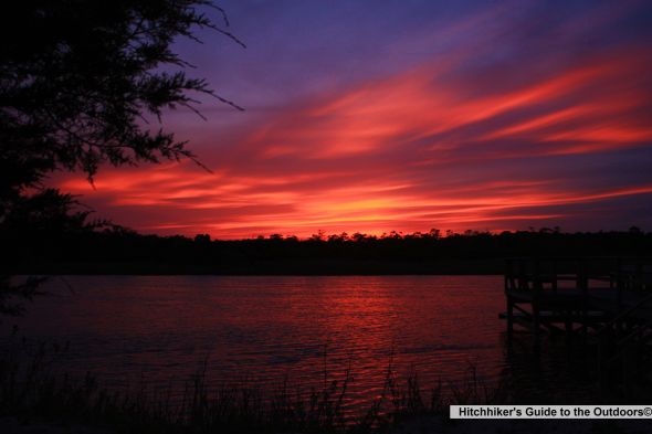
Pawleys Beach is about 5-10 miles away from Myrtle Beach, it’s a nice little beach with residential houses. I wondered around for 3- 4 hours in circle, experimenting with my new camera. The view of the sunset was rather disappointing from the beach so I started driving back and there it was, the sunset that I was looking for. It was so bright and full of colors. I parked my car at someone’s property and walked along private docks and took a bunch of pictures. I headed back to the Myrtle Beach area and walked along the boardwalk. It was getting late so I wasn’t sure where I was gonna sleep tonight. Click here for more pictures…

Sunset

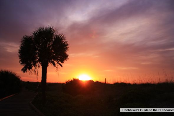
Day 4 (May 16th): I woke up around 6:15 am and I missed the sunrise by 10 minutes. I cannot believe I overslept in my car. I drove quickly back to Myrtle Beach State Park and took as many pictures I could. I walked around the beach and on the pier taking pictures. I saw the same group of fishermen on the pier from the previous day. It was a little too early to lay on the beach but that didn’t stop me. I took a nap but wasn’t sure what I was gonna do next so I decided to visit Brookgreen Gardens.

Myrtle Beach State Park

Myrtle Beach State Park

Brookgreen Gardens is located about 15 miles south of Myrtle Beach. It was founded in 1931 by Archer and Anna Hyatt Huntington to preserve the native flora and fauna and to display beautiful art in this setting. I strolled around the gardens where you can find sculpture in every corner. There are at least 500 sculptures in the garden.

My best part of the trip was cruising along the tributary creeks of the Waccamaw River on a pontoon boat along the abandoned rice field. The Creek Excursion tour provides a history of the rice plantation and slavery. The tour guide is informative and entertaining. There were several sightings of alligators. The trip was relaxing and cool, much-needed after strolling for hours on a hot humid day. Click here for more pictures..

Waiting for pontoon boat

The Low Country trail to the zoo is interesting with close up looks of fox, alligators, bald eagles, owls, and otters. The butterfly exhibit, “Whispering Wings,” was very disappointing. They did not have more than three species of butterflies. Although it is only three dollars in addition to the entrance fee, it’s not worth it. I guess they are trying to get more species of butterflies later. Click here for more pictures…

Butterfly

Charleston – Friendly & Historic Town

Day 2 (May 14th) continued: I wasn’t expecting my hike at Congaree National Park to be over so quickly so I wasn’t sure what I was gonna do next. I went to the visitor center where I spoke to this ranger with a beautiful southern accent. She suggested I need to go Charleston, according to her its way better than Myrtle Beach. There you go, that’s my new destination.

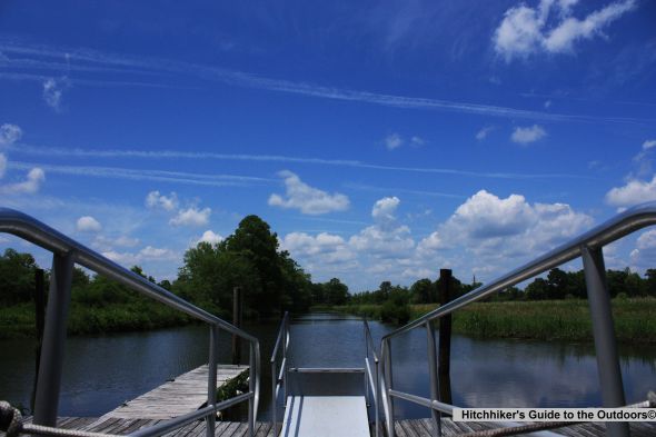
At dock enjoying the warm day

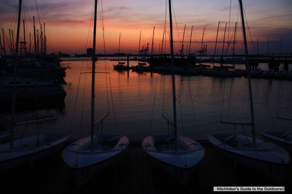
Charleston is about 2 hours drive from Congaree National Park. It’s a great city with lot of history from the Civil and Revolutionary Wars. The downtown was clean and walkable with lots of places to eat. As you walk along the historic downtown you can see well-restored 19th-century homes and gardens along narrow, tree-lined streets. I mostly wandered around downtown and the Waterfront Park. The people who I spoke to were friendly and helpful. I drove to Sullivans Island. I walked on the park below the Ravenal Bridge which crosses the Cooper River.  I sneaked into the resort boating area where I saw one of the beautiful sunsets. I almost spent 2 hours just wondering and taking pictures. It would had been really cool to walk along the Ravenal Bridge and take pictures but I was getting tired. At night, the city is active with nightlife, I saw some great places to dine and to drinks. Click here for more pictures…

Sunset under the Ravenal Bridge

Sunset

I like the color composition

As suggested by the park ranger, I spent the night at Notso Hostel. For $23 you get a dorm room, free Wi-Fi and free breakfast, it cannot get better than that. I took a much-needed shower and went to bed early to get over this nagging headache.

According to people who I spoke to, Folly Beach County Park and Isle of Palms are great beaches, unfortunately I did not get a chance to check them out. You can get more information about the city at http://www.charlestoncvb.com/

This one is my favorite

Congaree National Park – a floodplain forest

Day 2 (May 14th): I didn’t know this day was gonna start so early. The rest areas are not the quietest place. I was awake around 12:20 am. I was having a hard time sleeping with the constant traffic noise and lights but more importantly due to some old creepy guy. This old guy came close to my car every 20 minutes and started smoking his cigarettes. I am not gonna lie, it kinda freaked me out so I started driving to Congaree National Park. I reached the park around 3 am and parked my car at the visitor center, it was really quite and peaceful, I quickly fell asleep.

I was awake around 6:30 am and was ready for the first day of my adventure. My hiking bag was a little heavy, may be around 12-15 pounds with my new camera gadgets (including the tripod which I didn’t even use throughout my trip).

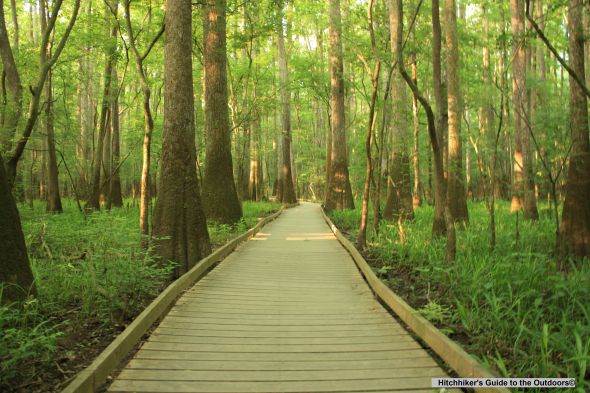
Congaree National Park located in central South Carolina was designated as a national park in 2003 which makes it one of the nation’s youngest parks. The park preserves a stretch of old growth lowland forest in the United States. It has some of the tallest trees in Eastern US. There are about 75 species of trees and some of the most common ones are tupelo, laurel oak, ironwood, American holly, loblolly pine, paw paw, water oak and bald cypress. The park is home to about 175 bird species, I might have seen at least 10-15 species of birds. The most common one that I saw was the red-cockaded woodpecker. The park offers bird watching, canoeing, kayaking and hiking. You can find more information about the park and trails at: http://www.nps.gov/cong/index.htm

Here are the trails that I hiked during my visit:

Bluff Trail – 1.7 miles

I started this trail from a primitive campground where I parked my car. This trail is easy and was a good warm up for me. There was nothing exciting about this trail besides loblolly pines and mixed hardwoods. But watch out for little creatures (lizards) as they expose themselves when it gets hotter.

Boardwalk – 2.4 miles

Low Boardwalk

This is not the typical boardwalk that you walk along the sea-side. This elevated boardwalk is built above the forest floor which passes through a primeval swampy flat and a mixture of hardwoods and upland pines. This boardwalk is divided into Low Boardwalk (1.1 miles) and Elevated Boardwalk (1.3 miles). This must be one of the most popular trails at the park. The park ranger offers guided tours along the boardwalk, if you miss one of these tours please carry one of those self-guided boardwalk tours available at the visitor center. As you walk along the boardwalk you will find the number on the handrails or the walk boards which corresponds to the number in the brochure. I found this brochure very helpful. I started this trail with Low Boardwalk which passes through a primeval swampy flat. The cone-shaped cypress that protrudes from the floodplain’s wet soil makes you feel like you are in some different planet. The Elevated Boardwalk offers a display of massive pines and tall trees. The boardwalk ends at Weston Lake where you can see snapping turtles and fish.

Weston Lake Loop Trail – 4.4 miles

looks like two butt cheeks over one another

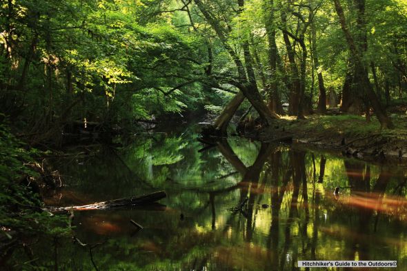
This loop follows the northern bank of Cedar Creek before connecting to Low Boardwalk. I got a little adventurous while taking pictures of the creek, so went off the trail and tried to stand on the bank of the creek. Not the brightest idea!! My foot got completely submerged, it was thick and sluggish. I almost lost my hiking boots and was able to grab on the roots and crawl back to the trail. And I also forgot to wear my hat, not the smartest thing again. There were bugs and flies all over my head; it was like some breeding camp. I just couldn’t get rid of it, after a while I was getting used to it. I didn’t do the whole loop, after a mile or so I jumped to Oakridge trail.

Oakridge Trail – 6.6 miles

Wise Lake

This is probably my favorite trail. I saw lots of wildlife on this trail. About 2 miles into the trail, I saw this black creature in the bushes about 3 to 4 feet tall. It was making this sniffing noise; I still wasn’t sure what it was. I approached it very slowly and quietly. I was about 10 feet away when I was getting ready to take a picture, and it saw me, made a loud noise, and started running away. It scared the hell out of me; it was a wild boar. That thing can run fast, glad it did not run toward me. The trail crosses a number of small creeks, and you can also see Wise Lake. I almost thought of doing River Trail; I was running low on gas so I decided to head back to the visitor center.

This may be the smallest park in the nation; a day is more than enough to hike most of the trails in the park. I mostly enjoy hiking mountains and canyons; this was definitely a different experience. The trails are flat as you walk along the creeks and swamp; you can enjoy the dense forest, wildlife and floodplain biodiversity which makes this place very unique. You should try to stand still for a minute and observe what’s happening around you. You can feel the solitude as you are surrounded by old-growth forest yet accompanied by many other lives – lizards crawling under the bushes, squirrels, ants, spiders, birds as big as your thumb and if you are lucky maybe even a wild boar. Overall, the park management has done great job maintaining the trails and they are all well-marked. Click her more pictures…

Road Trippin – South Carolina “the Palmetto State”

Day 1 (May 13th): It’s been a hectic three weeks with projects and finals as I completed my first year of a Masters in Applied Economics. I have been out of touch with nature, and I have been waiting to re-strengthen this relationship after my finals. But the weather forecast for next whole week wasn’t hiking friendly – rainy and scattered thunderstorm throughout the week. I just wanted to go somewhere for a drive, away from Blacksburg, so I decided on Myrtle Beach. I haven’t been to any beach for almost 6 months, and I heard a lot about this place. As I was looking at my Atlas road map, I found Congaree National Park which is just 2 hours from the beach. That’s perfect!! It’s like hitting two birds with one stone.

Congaree National Park is located about 5 hours from Blacksburg, so I started driving around 6:30 pm. I didn’t have any place to stay but had enough food packed for 3-4 days. As I started driving, there were interesting cloud formations in the sky. With newly learned tricks on my camera, I have been interested in taking picture of clouds, the sunset, and sunrise. These huge dark clouds were trying to take over the sky and the sun was doing its best to keep them away. This battle continued for another hour or so. In this battle, the sun was successful in stretching and scattering these clouds into a million pieces. As they got lost in the sky, I could finally see a blue sky. The dark clouds made a final attempt as they completely covered the sun. As everything turned dark and gloomy, sun rays pierced through the dark clouds. The clouds looked like they were getting rusted as it got scattered and turned the whole sky red. It looked like a blood bath. With this bright and vibrant color, the sun won this battle as it rested between the mountains.

My words cannot explain this dramatic sunset as I was driving on I-77S. I tried to stop a couple of times but wasn’t able to capture this panoramic view with my camera. The image still remains fresh in my memory. I know sunsets are not a rare commodity. They come and go every night, and I know I will see another spectacular sunset somewhere. Next time, I will be there ready with my camera.

After driving for 4 hours or so, I was getting tired so I decided to take a shelter at some rest area. So I got myself comfortable and slept in my car thinking about my destination, just 65 miles away from me.

Personal Update 06.04.2010

I was mostly busy with graduate research this week. I still haven’t figured out my traveling dates for my summer trip. One of the main obstacle holding me up has been apartment search, but I have some good leads so hopefully I will sort that out next week.

This weekend I am planning to hike Shenandoah National Park and go see my friend Shahnila in Washington DC before she leaves for Singapore. Here are the trails that I am planning to hike: Old Rag (8 miles); Hawksbill Mountain (2.9 miles); Rose River Loop Trail (4 miles); Stony Man Mountain (3.7 miles) & Bearfence Mountain (1.2 miles). Hopefully I can hike all of them.  That’s it for now.

New Camera

I have always been interested in taking pictures but since I started hiking, my passion for photography has reached a new level. I have been using a Canon PoweShot SD 1000 to take most of my pictures.  I enjoyed its size and portability and it also provide a decent image quality with 3X zoom. But I think it’s about time to upgrade my camera. I did lot of research and I am thankful to my friends Zarif and Tushar for their advice and answering all my questions.

It is easy to do some Google searches and find hundreds of websites/blog posts that offer great advice on buying a new camera. However, I think two important questions to ask yourself are – why you need the camera and how much you can afford or want to spend.

There are a lot of websites that offer reviews on cameras but my favorite is cnet.com. Here is the link that offers a Digital SLR camera buying guide and a Digital camera buying guide. There are hundreds of websites that you can buy your camera from so make sure you check most of them for better price bargain. Here are few that I used before I bought mine – Amazon, Used Cameras, B&H Photo and Abes of Maine.

I finally bought Canon Digital Rebel XSi, an entry level digital SLR for an amateur photographer like me. With SLR cameras, the learning curve is pretty steep, so I also bought Canon EOS Digital Rebel XSi/450D for Dummies to get familiarized with its features and uses. I have not been able to go on hikes since I bought my new camera so I have been walking around my neighborhood with it or go on little drives taking pictures of anything that I found interesting. Here are few pictures with my camera. Click her for more…

Pandapas pond

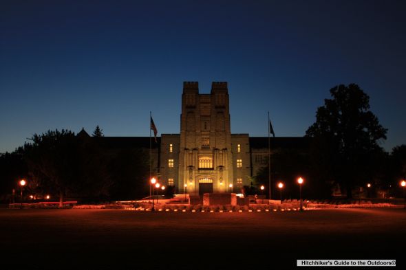
Virgina Tech

War Spur, Wind Rock & Mountain Lake

On April 16th, 2010, I went hiking to War Spur with my energetic and talkative friend Olivera and not to mention she loves taking picture of herself. We drove through Mountain Lake Resort where the movie Dirty Dancing, starring Patrick Swayze, was filmed in one of the cabins there. We drove pass the resort and the mountain lake, on to a dirt road to reach War Spur and from there we drove further down on a bumpy road (about a mile or so) to Wind Rock trailhead. These trails are located less than 25 minutes drive from Blacksburg. Both trails are short and easy, and each leads to scenic overlooks.

War Spur

War Spur

The War Spur is also known as Chestnut loop near Mountain Lake. This 3 mile loop trail offers panoramic mountain views. From the trail head, we hiked clockwise. The trail passes through thick patch of rhododendron and there is a small stream that crosses the trail. The trail is mostly flat but there are some parts with gradual steep walks. Then the trail comes to an intersection which leads to War Spur overlook. The view from stacks of rocks is gorgeous and you can see some mammoth hemlocks which is one of the main highlight of this hike. The trees were still recovering from winter, it was perfect day with blue sky and cool breeze. The scattered clouds were casting its shadow on the nearby mountains. After spending almost half hour obviously taking pictures of Olivera, we continued the loop clockwise. We saw few chestnut trees along the way as we reached the parking lot. Parking is free but limited. Click here for more pictures…

Wind Rock

Wind Rock

We drove another mile or so to Wind Rock trailhead. The road is very bumpy especially when you have small car like mine. My car was suffering, I could feel her pain. From the parking lot its a quarter-mile hike which leads to a sweeping views of nearby mountains in Jefferson National Forest. You can probably figure out from its name, it’s pretty windy out there. I also saw little snake between the rocks but I wasn’t quick enough to snap any pictures. If you are planning to hike War Spur, make sure you visit Wind Rock, it’s totally worth it. Click here for more pictures…

Mountain Lake

Mountain Lake

On our way back we stopped at Mountain Lake to explore the lake and boulders around it. Virginia only has two natural fresh water lakes and Mountain Lake is one of them. Mountain Lake is not part of the Jefferson National Forest but people hike the surrounding national forest.  The lake looked like it was dying. We walked along the lake and climbed one of the boulders and took bunch of pictures before we headed back. Click here for more pictures…

How I got here?

  • Head out of Blacksburg on US-460 West toward West Virginia
  • You will see a sign for Mountain Lake after 10 miles or so
  • Make a right on Mountain Lake Road and follow the sign
  • Drive through the resort and past the actual lake and onto a dirt road
  • About  two miles on this dirt road, you will see a parking area for War Spur