Death Valley National Park –Land of Great Extremes
On March 10th, 2010, we drove to Death Valley National Park which is only 135 miles from Las Vegas. We stayed on Hwy 95 for most of the drive, this route is also known as the Ghost Town Route. Unfortunately, we missed our turn and as a result we had to drive additional 25 miles just to find a spot to turnaround. There were no gas stations or any lighted areas/cities throughout the drive. We arrived at the Death Valley’s National Park visitor center around 11 PM. As planned, we slept in our car which wasn’t that comfortable. After twisting and turning, we finally managed to get some sleep. We were up and ready by 6 AM for our last day of adventure.
Death Valley got its name from gold-seekers, crossing the valley during the 1849 California gold rush. It’s a planet in itself – hot arid climate, the temperature can easily rise up 120 in summer; drastic landscapes changes from the lowest point in northern hemisphere to Telescope Peak which is double the height of the Grand Canyon; strange colorful rock formations-red, yellow, purple, green, blue you name it; sand dunes; beautiful seasonal wildflowers and nearly 1,000 native plant species and other aquatic animals found nowhere else. It is one of the hottest places in the world. Here is an interesting fact, Death Valley averages less than 2 inches of rainfall a year. Further due to high temperatures and low humidity, causes extreme high evaporation rate which is 128 inches annually, 77 times the precipitation rate. I highly recommend traveling in winter or spring and make sure you bring enough water. Click her for more pictures…
Badwater Basin
This is probably the best known and most visited place in Death Valley. We were there around 6 AM, so we didn’t have worry about any other tourist besides group of professional photographers. They were all there to capture beautiful morning with a perfect reflection of Telescope Peak on bad water. Yes there is actually bad water at Badwater. I even tried tasting it, it wasn’t pleasant. As the story goes, after a long walk, a man brought his mule to this pool of water. The mule refused to drink the water whereupon it got its name “Badwater.”
The Badwater basin has the lowest elevation in US, 282ft below sea level. You can park your car and walk to the salt flats. There is a boardwalk which allows you to stroll over the salty stagnant water but you can continue to walk across the salt flats. There is a sign mentioning “sea level” on the flank of the rock above the road. There was a decent amount of water but during the summer it dries up. Please be careful while walking on these salt flats, they are very fragile. I was destroying it while walking on it until I realized I needed to step on the water pockets/middle of flats rather than the edges. We walked on the flats for half an hour or so but we had to stop since the water was getting deeper. It’s a beautiful landscape as you can stand at the lowest point in northern hemisphere surrounded by endless stretch of distant mountains which includes Telescope Peak, which is the highest point in the park.

- Telescope Peak from badlands
Zabriskie Point
We headed back to visitor center to get some maps and ask a ranger about the trails. The ranger that we spoke to was very helpful and nice. Zabriskie Point is definitely one of the most scenic areas in Death Valley. It’s at a short distance after you enter the park from the east. From the parking area there is a short, paved path leading to the viewpoint. The mountains here display white, yellow, light and dark gray with distinct wrinkles or may be parallel ripple marks.

- view from Zabriskie Point
Gower Gulch Loop – 4 miles
As recommended by our ranger we hiked this picturesque, narrow, and geologically interesting canyon trail. The trail immediately enters and ascends a narrow canyon with colorful walls, ripple marks in the rocks. The trail passes through great views of Red Cathedral cliffs. The trail gets steep as you cut though the side of Manly Beacon, and at this point we got a spectacular view of the badlands and the canyons. Along the way, I also saw many abandoned mines. Overall, a moderate hike but make sure you have enough water.

- View of badlands from Gower Gulch Loop
Artists Drive – 3.4 mile
This narrow drive displays myriad colors of rocks caused by minerals within. Some of the prominent colors were red, pink, yellow, green and purple. These colors are at their best around the sunset, we were there at the wrong moment.
Mesquite Sand Dunes
Before we reached mesquite sand dunes we passed Devil’s Cornfield. The sparse vegetation is so windswept that it stands out dramatically. I have never seen sand dunes before, so I was really looking forward to it but my timing was wrong. If you want to take some stunning pictures you should be there for sunrise or sunset. There are no trails, so you can hike as long as you can. We wandered up, down and around the sand dunes until my camera died.
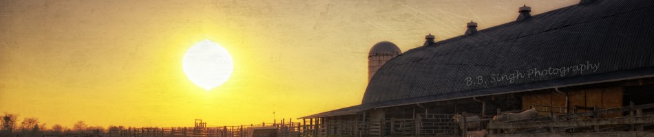
Scenic Drive Back to Las Vegas
There are four routes to get back to Vegas from Death Valley. As suggested by ranger we took the most scenic route which is an extra 30 mile drive. We were glad we took this route, it was very scenic with very few cars. We stopped multiple times and took a bunch of pictures. If you have some time and you are flying out of Vegas, I highly recommend this route; it’s worth the extra miles.

- Starting our scenic drive
We couldn’t go to Dante’s Peak and Devil’s Golf Course due to the snow and muddy conditions. We didn’t have enough time to see Scotty’s Castle and hike some of the other trails. There are miles and miles of back roads and 4×4 trails that we did not have enough time to explore. Death Valley National Park has a lot to offer; you need at least more than couple of days to explore this Land of Great Extremes.


